

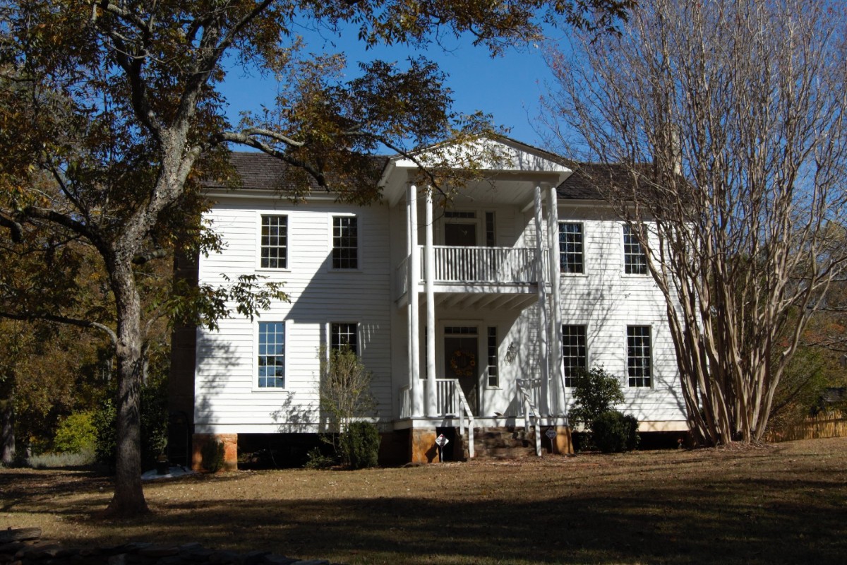
Current view of Elisha Winn House, where Gwinnett was founded.
(Editor’s note: Enjoy this glimpse of the history of Gwinnett County before it was founded. The author is a former chairwoman of the Gwinnett County Commission and most recently president of the Gwinnett Historical Society. –eeb)
By Charlotte Nash
DACULA, Ga. | Thousands of years before Europeans came to Georgia, Native Americans lived in what is now Gwinnett. Two groups were dominant in Georgia when the colony was founded: the Cherokees in the north and the Muscogee, or Creeks, in central and south Georgia.

Nash
The area now in Gwinnett County was near the dividing line between the two groups, with the boundary’s exact location shifting over time. Reminders of these early occupants of Gwinnett’s land include place names, like Chattahoochee, Apalachee and Suwanee, while echoes of Indigenous peoples are also found in a few surviving rock structures and remnants of stone tools.
Although some whites settled illegally in the Gwinnett area earlier, it was officially opened for settlement after the American Revolution. Prior to then, the frontier boundary was located to the east. However, the new nation and its states quickly focused on westward expansion. In 1783, the Cherokees ceded all their land east of the Oconee River to the State of Georgia.
Since the Apalachee River is a tributary of the Oconee, its basin was included in the ceded area. The headwaters of the Apalachee River, just west of where the current intersection of Georgia Highways 124 and 324 is located, marked the new frontier boundary. It is no coincidence that Fort Daniel and at least one previous fort were situated here, as a series of frontier forts were built in the late 1700s and early 1800s to protect settlers.
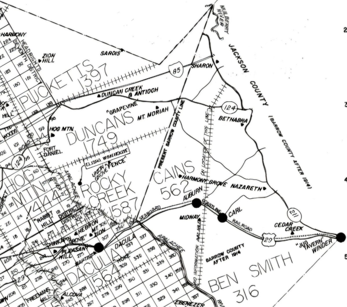
The unshaded area is headrights land. The large type refers to the Militia District..
When Franklin County was created in 1784, it encompassed the newly ceded area. Thus, part of Gwinnett was initially located within Franklin County. This portion of Gwinnett, north of Dacula and east of Hog Mountain, is known as the headrights district based on the method used to distribute land to settlers there. In 1796, the western half of Franklin was taken to form Jackson County, and Gwinnett’s headrights district became part of Jackson County.
Some settlers came to the newly created Franklin County from parts of Georgia to the south along the Savannah River and the coast, but most came from the Carolinas and points to the north. A likely route followed by many was the Upper Road that ran from Fredericksburg, Va. through North and South Carolina before reaching Georgia. The Upper Road crossed into Georgia near where Interstate 85 now enters Georgia from South Carolina, illustrating the linkage between modern roadways and those of earlier times.
When Gwinnett County was created in 1818, official settlement of its headrights district, including the area that would become part of Barrow County in 1914, had already been underway for several decades. Many of the early leaders of Gwinnett, like Elisha Winn and William Maltbie, settled in the headrights district during this pre-Gwinnett period. In fact, Elisha Winn’s home just north of the Apalachee River near Dacula that served as the first seat of Gwinnett’s government pre-dates Gwinnett’s formation.
The early days of Gwinnett County, though, provided a portent for its future as the fledgling county’s population almost doubled from 1820 to 1830!
- Have a comment? Click here to send an email.


Follow Us